Audio Guide: Open Area: Silos and Pits
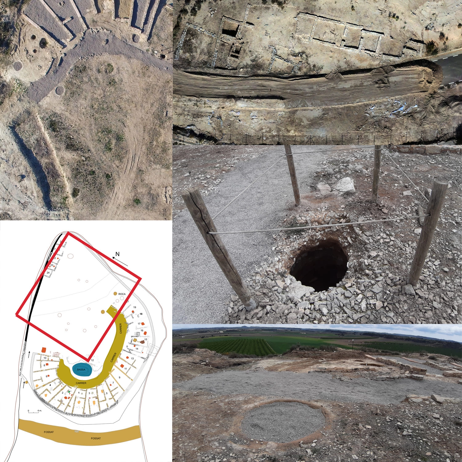
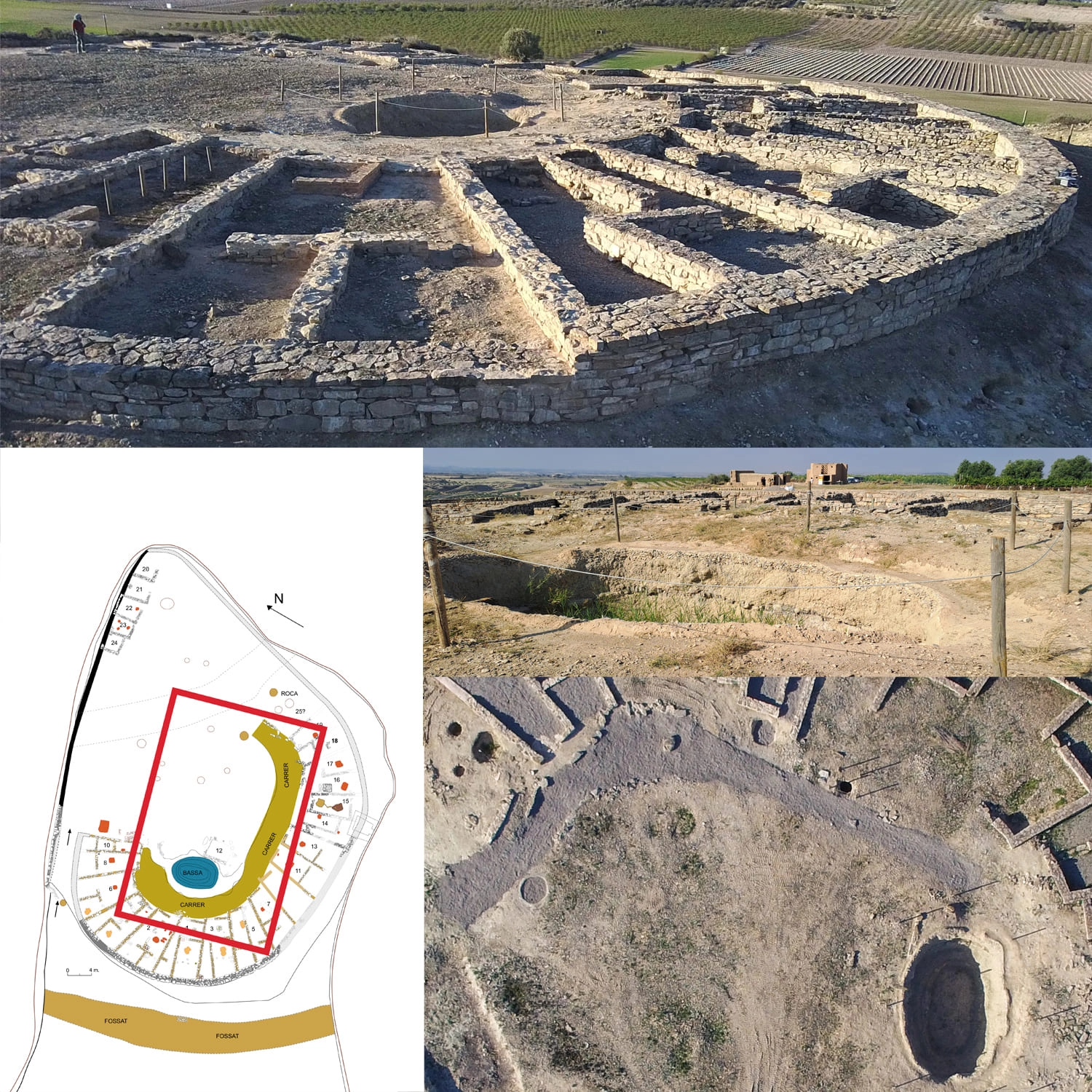
Occupying the central ground between the cistern, the entrance gate, and the southern sector of the wall, there is a large, expansive open space. Unlike the densely packed housing districts, this zone remained free of permanent buildings, suggesting its role as a dedicated area for collective work and communal activities.
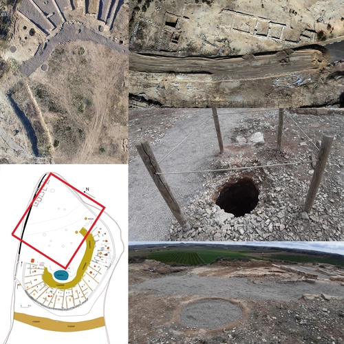
In the southern part of this open area, archaeological excavations have identified various silos and pits. These structures served a range of purposes, including grain storage and specialized industrial processes such as textile production and dyeing. Across the large esplanade, excavations revealed numerous postholes.
These indentations in the natural terrain are interpreted as the remnants of a wooden enclosure, likely designed for keeping livestock. The Iberian settlements of the Ilergècia region relied heavily on animal husbandry as their primary economic pillar.
This hypothesis is further supported by the scarcity of grain-storage silos at Els Estinclells. This stands in marked contrast to coastal settlements of the same period, where vast fields of silos are commonly found, indicating a focus on large-scale cereal storage for regional trade.
As observed throughout the visit, the settlement contains a total of only eight silos. This limited number indicates that storage at Els Estinclells was a communal system designed specifically to sustain the local population, rather than to accumulate large surpluses for commercial exchange.
Crossing the western area is a massive trench—measuring 28 meters in length, 6 meters in width, and approximately 65 cm in depth—that cuts deep into the terrain.
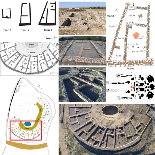
This excavation creates a clear separation between the modest eastern housing district and the settlement’s core, including the main street and the cistern.
Archaeological analysis of the materials recovered within this trench confirms it was an ancient intervention, contemporaneous with the occupation of the site. The location and alignment of this trench are highly significant. It traces a direct line toward the lower slope where a Roman mansio was later established.
This leads researchers to a compelling interpretation: after the abandonment of the Iberian settlement around 200 BC, the site was systematically looted. The trench likely served as an access route to dismantle the stone walls of the Iberian structures, which were then transported down to be repurposed for the construction of the Roman mansio under the new Roman administration.
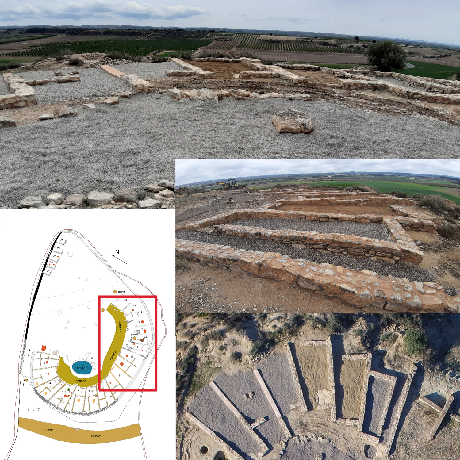
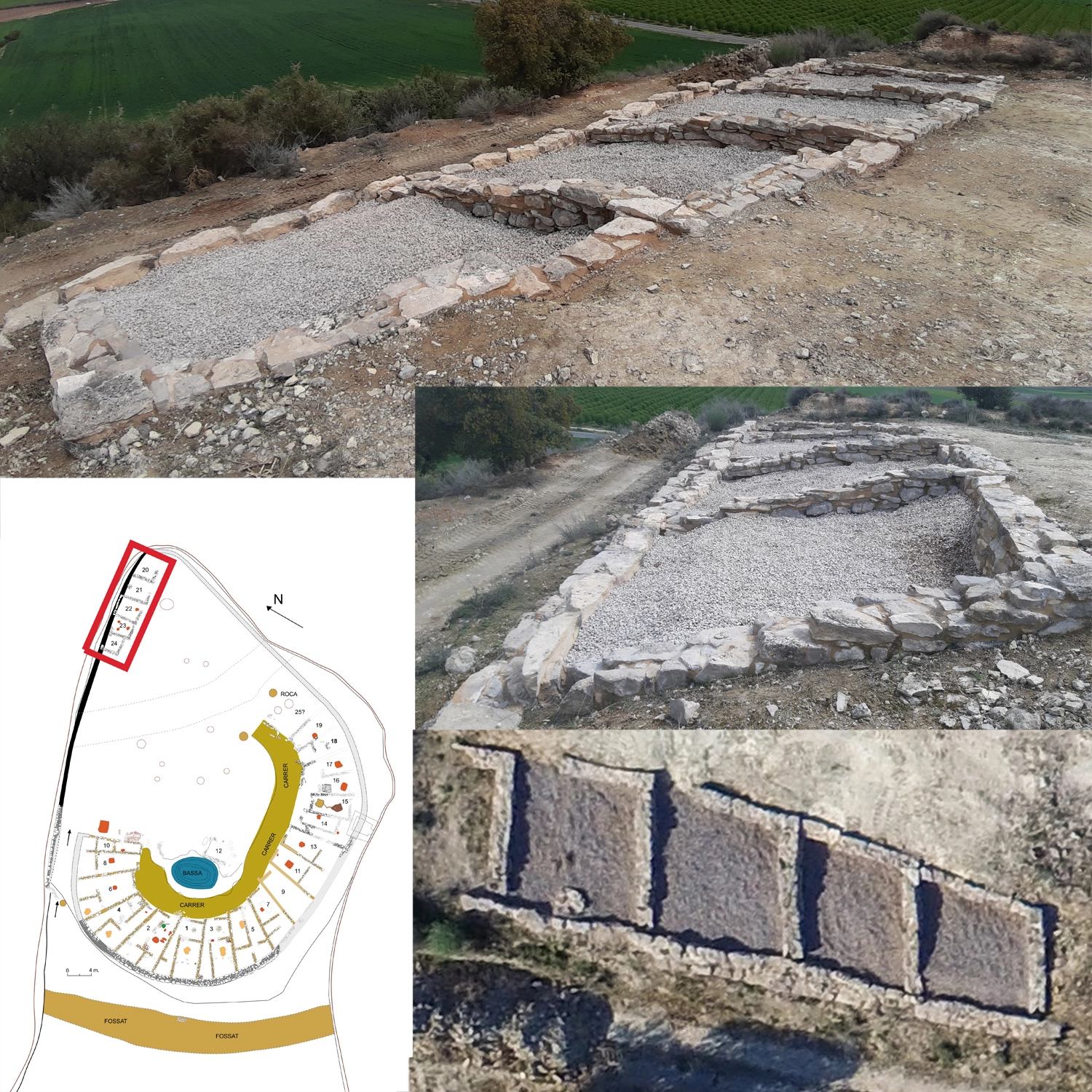
To illustrate this phenomenon of stone robbing (spoliation) for the visitor, specific walls at the end of the simple housing district have been reconstructed. These reconstructed volumes are rendered in a slightly pinkish-toned lime formwork. This deliberate choice allows visitors to visually distinguish between the original, well-preserved walls and those that were found “leveled.” In the excavation process, only the negative imprint of the foundation trench remained after the stones were removed.
These specific structures represent the walls that were likely dismantled and transported down the ramp, following the path of the large trench toward the Roman occupation area below.
All points of interest:
1. Ditch and Wall Area
2. Settlement Entrance and Gate
3. Circular Street and Basin
4. Complex Housing District
5. Simple Housing District
6. Pressing Workshop
7. Open Area: Silos and Pits
8. Tiny Housing District
9. The Protohistory Experimental Field
10. Agricultural Area
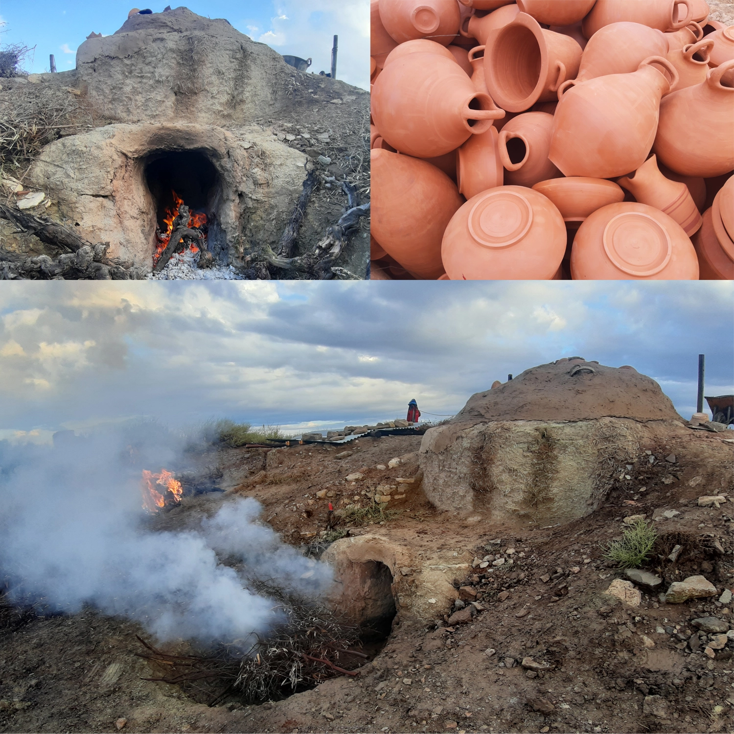
11. Craftsmanship Area